UK launches flood taskforce to prepare for extreme winter weather
The British government has convened a dedicated flood taskforce to prepare for extreme winter weather amid warnings of an unprecedented global El Niño cycle.

- Core Development: The British government has convened a dedicated flood taskforce to prepare for extreme winter weather amid warnings of an unprecedented global El Niño cycle.
- Beat Context: Categorized under Weather with independent corroboration.
- Reporting Depth: 3 minute analytical read synthesized from verified newsroom sources.
The British government has convened a dedicated new flood taskforce to prepare the country for extreme winter weather. Officials are mobilising ahead of what forecasters describe as a heightened potential for wet, windy, and stormy conditions in the coming months, following a summer of record-breaking temperatures across the UK.
The Department for Environment, Food and Rural Affairs (Defra) hosted the inaugural meeting bringing together the Met Office, the Environment Agency, mayoral authorities, and representatives from the farming, water, and insurance sectors. According to Aol, Defra Minister Emma Hardy emphasised that the government is taking decisive action to manage intertwined flood and drought risks by putting communities and businesses at the heart of preparedness efforts. The government has committed funding up to 2036 to protect homes, businesses, and critical infrastructure from the growing threat of flooding.
Media additions
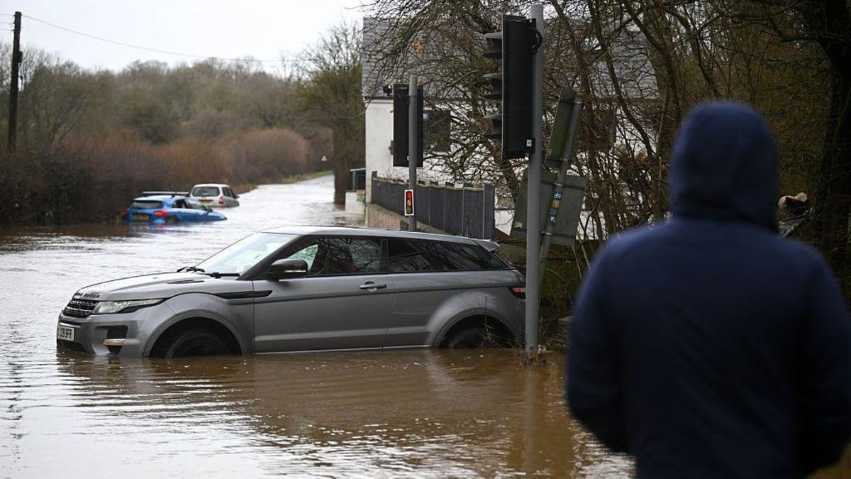

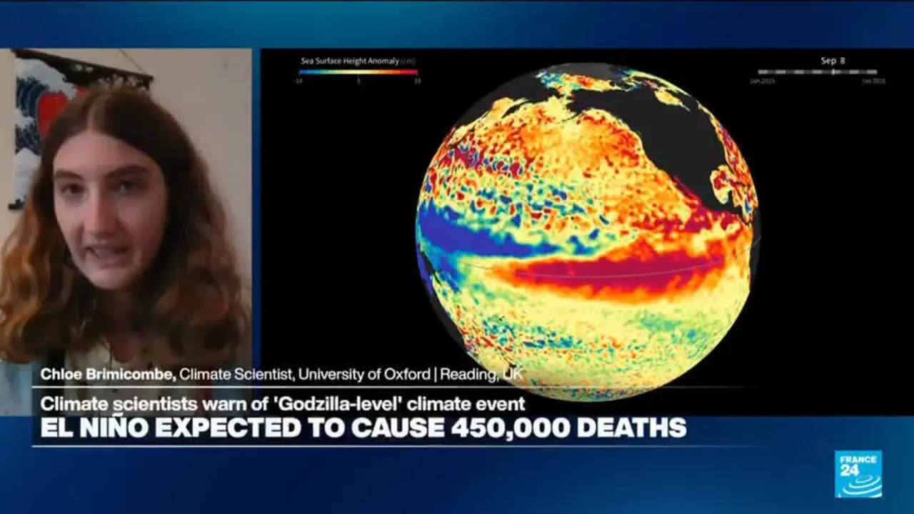
The urgency behind the taskforce stems from compounding meteorological warnings regarding this year’s El Niño. According to The Independent, the head of the United Nations weather agency warned that the naturally occurring Pacific warming cycle could be unprecedented in strength and off the charts compared to the last four decades. Data from the World Meteorological Organization indicates that sea surface temperatures in the central and eastern tropical Pacific are forecast to reach record levels as the phenomenon intensifies toward its winter peak.
While the British Isles lie thousands of miles from the tropical Pacific, domestic forecasters explain that atmospheric teleconnections link these distant ocean shifts to European weather patterns. The Met Office has noted that El Niño increases the chances of wetter, stormier conditions for northwest Europe during autumn and early winter. Humanitarian groups such as the British Red Cross have cautioned that these atmospheric shifts also elevate the likelihood of sharp winter cold snaps, which carry risks of power cuts, high winds, and heavy snowfalls.
Concerns are amplified by memories of previous super El Niño years. Reporting by AOL Canada highlights that the last comparable event during the winter of 2015 and 2016 brought destructive storms such as Storm Desmond and Storm Katie. That winter saw severe gales, transport suspensions, structural damage in London, and major flooding across northern England and Scotland. Professor Adam Scaife, Head of Long Range Prediction at the Met Office, noted that the current developing event has already surpassed previous records even before reaching its seasonal peak. Met Office climate spokesman Grahame Madge echoed these concerns, pointing to historical teleconnections that favour a stormier start to the season followed by colder spells toward the end of winter.
| Metric / Factor | Previous Super El Niño (2015/16) | Current Outlook |
|---|---|---|
| Magnitude | Lower magnitude than current cycle | Surpassed previous records before peak |
| Projected Impacts | Storm Desmond, Storm Katie, widespread flooding | Heightened potential for wet, stormy weather and cold snaps |
| At-Risk Properties | Thousands of homes affected across northern England | Approximately 6.3 million homes and businesses at risk in England |
Domestic agencies are urging proactive measures across the country. The Environment Agency reports that approximately 6.3 million homes and businesses in England remain at risk of flooding. Households are advised to check their local flood risks, sign up for automated alerts, and prepare personal emergency plans.
What to Watch Next
- The Met Office and international weather agencies will continue monitoring tropical Pacific sea surface temperatures as El Niño approaches its anticipated peak.
- Government taskforce members will assess ongoing regional preparedness, infrastructure resilience, and catchment saturation levels.
- Forecasters will evaluate stratospheric polar vortex developments later in the season to determine whether freezing Arctic air masses will be channelled southward into the UK.
How significant is this development?
Contribute your assessment to the aggregated reader sentiment ledger.
Frequently Asked Questions
Key questions answered in this reportWhat is the key development in: UK launches flood taskforce to prepare for extreme winter weather?
The British government has convened a dedicated flood taskforce to prepare for extreme winter weather amid warnings of an unprecedented global El Niño cycle.
Why is this Weather development significant for the UK?
This report covers critical events in our Weather beat. Independent reporting monitors related UK statements, regulatory shifts, and public responses as further verified details emerge.
How was this reporting corroborated and verified?
Newsarchy UK compiles and cross-references reporting from primary reporting from The Sunday Guardian and cross-checked wire reports. All coverage adheres to published editorial standards.
When was this report published?
This briefing was published on October 22, 2026 and is permanently cataloged in the Newsarchy UK Weather archives.


