Met Office issues new wind warnings as fresh storm system approaches UK
Fresh wind warnings have been issued across parts of the UK as another deep low-pressure system approaches following the disruption caused by Storm Boelo.

- Core Development: Fresh wind warnings have been issued across parts of the UK as another deep low-pressure system approaches following the disruption caused by Storm Boelo.
- Beat Context: Categorized under Weather with independent corroboration.
- Reporting Depth: 3 minute analytical read synthesized from verified newsroom sources.
Following a weekend of severe disruption marked by gale-force gales and widespread flooding, the Met Office has issued a fresh series of wind warnings as another deep low-pressure system approaches the UK. The incoming weather front follows the turbulent impacts of Storm Austen and Storm Boelo, a rapid succession of severe weather events driven by an active jet stream that has left transport networks strained, events cancelled, and communities grappling with power outages.
The transition comes as Storm Boelo clears away from the UK, leaving behind a temporary calmer interlude. However, this respite will be short-lived. According to Bbc Weather, a renewed low-pressure area is deepening as it tracks in from the Atlantic, threatening to bring another wave of heavy rain and strong gales to western and northern regions.
Media additions
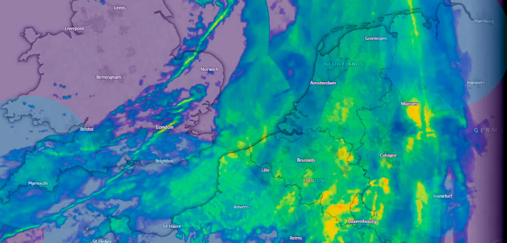


The Met Office has issued a yellow wind warning valid from 03:00 until 23:59 GMT on Tuesday, spanning almost the entirety of Scotland—excluding Shetland—along with parts of northern England and the north coast of Northern Ireland. Widespread gusts of 50 to 60mph are anticipated, with speeds potentially exceeding 70mph around exposed coasts. While forecasters note this system is unlikely to be as widely disruptive as its predecessors, its impacts could be magnified because it arrives so soon after the saturated ground and battered infrastructure left by Storm Boelo.
The weekend storms caused catastrophic damage across Britain. Dailymail reported that two men lost their lives in separate incidents involving falling trees: a 60-year-old man in Dumfries, Scotland, and a man in his twenties crushed in his car in north London. Infrastructure damage was extensive, with the Energy Networks Association revealing that tens of thousands of homes experienced electricity interruptions.
| Storm System | Peak Recorded Wind Speed | Key Impact Areas | Primary Hazards |
|---|---|---|---|
| Storm Austen | 76 mph (St Mary's Airport) | Southern UK, South-West England, Wales | Structural damage, localized power cuts, 20-30mm rain |
| Storm Boelo | 85 mph (Machrihanish, Scotland) | Scotland, Northern Ireland, Northern England, Wales | Flooding, structural damage, fatal tree falls, power outages |
| Incoming System (Tuesday) | 50-70 mph (forecast) | Scotland, Northern England, Northern Ireland | Travel disruption, flying debris, residual flooding |
The succession of storms also forced widespread cancellations of public events and transport services. As detailed in reporting by Beinsure, events such as Liverpool’s River of Light and London's Diwali on the Square were called off on safety grounds, while Edinburgh Castle closed its gates to visitors.
The naming convention utilised by the Met Office, Met Éireann, and KNMI tracks these intense Atlantic systems through an alphabetical seasonal list, which began this year with Storm Austen and continued with Storm Boelo. Forecasters are currently monitoring whether the incoming Tuesday system will intensify sufficiently to be designated as the next named storm on the roster.
Looking ahead, relief is in sight for later in the week. According to Met Office forecasts, high pressure is expected to build close to the UK from Wednesday onwards, allowing showers to clear and leaving Thursday morning crisp with potential mist and fog. While a weather front may introduce damp conditions to western areas by Friday, computer weather models indicate that a drier and calmer spell will establish itself over the weekend and into the following week. Readers are advised to monitor local weather coverage for real-time updates as Tuesday's warnings take effect.
How significant is this development?
Contribute your assessment to the aggregated reader sentiment ledger.
Frequently Asked Questions
Key questions answered in this reportWhat is the key development in: Met Office issues new wind warnings as fresh storm system approaches UK?
Fresh wind warnings have been issued across parts of the UK as another deep low-pressure system approaches following the disruption caused by Storm Boelo.
Why is this Weather development significant for the UK?
This report covers critical events in our Weather beat. Independent reporting monitors related UK statements, regulatory shifts, and public responses as further verified details emerge.
How was this reporting corroborated and verified?
Newsarchy UK compiles and cross-references reporting from primary reporting from BBC and cross-checked wire reports. All coverage adheres to published editorial standards.
When was this report published?
This briefing was published on October 26, 2026 and is permanently cataloged in the Newsarchy UK Weather archives.