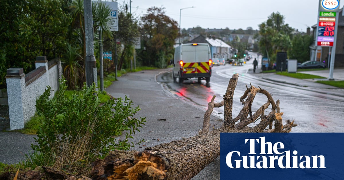
Cooler temperatures with wet and windy weather forecast for UK this week
The UK is experiencing an abrupt transition to unsettled weather as an Atlantic low-pressure system brings widespread rain, gales, and flood warnings.

- Core Development: The UK is experiencing an abrupt transition to unsettled weather as an Atlantic low-pressure system brings widespread rain, gales, and flood warnings.
- Beat Context: Categorized under Weather with independent corroboration.
- Reporting Depth: 4 minute analytical read synthesized from verified newsroom sources.
Meteorological summer has officially drawn to a close, and school bells are ringing across the nation as the UK transitions abruptly into a much more unsettled phase of weather. Following a sharp heat spike that pushed thermometers close to seasonal highs in parts of the country, a deep low-pressure system is sweeping in from the Atlantic, bringing widespread wet and windy conditions that are set to dominate the early part of the week according to BBC reporting. Drivers, commuters, and holidaymakers are being urged to adapt to rapidly changing conditions as cooler Arctic air collides with lingering warmth.
According to primary forecasts detailed by the BBC, a cold front marked by fresher air is pushing down from the north-west, bringing cloud bands and scattered showers across England and Wales. Meanwhile, Northern Ireland and western Scotland are bearing the brunt of heavier rainfall and gusty south-westerly winds, which are capping daytime temperatures locally. Forecasters highlight that while southern areas enjoyed relative warmth at the start of the period, the influx of windier and more humid Atlantic air will continue to test flood defences in regions already struggling with prolonged dry spells and ongoing drought conditions.
Media additions

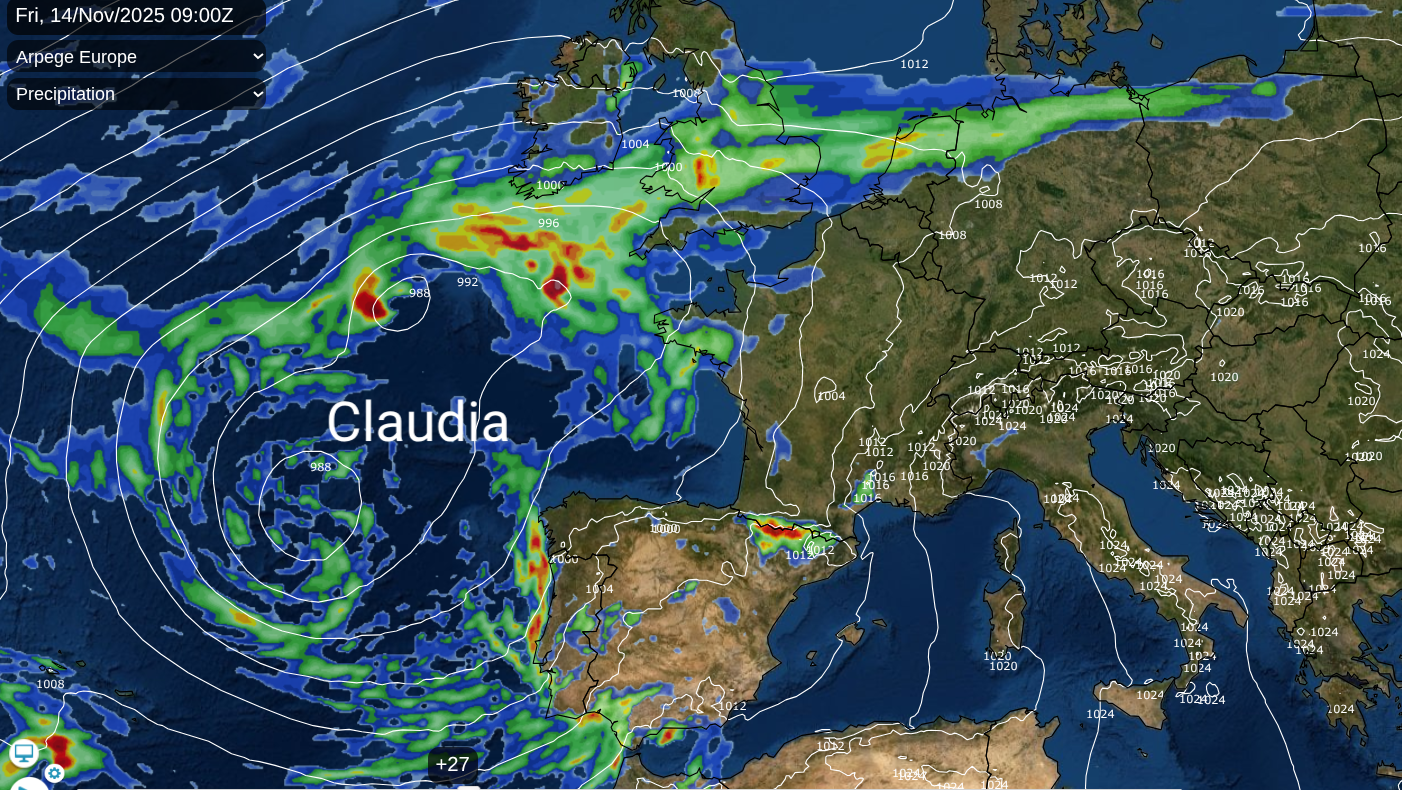
The wider European weather picture has added fuel to these dynamic systems. Spanish meteorological authorities named an extensive eastern Atlantic low-pressure system Claudia
— sitting outside the UK's standard naming convention — after it generated severe weather warnings, torrential rain, and thunderstorms across the Iberian Peninsula according to Netweather. This system has driven heavy rain northward into the English Channel, merging with cold air masses and triggering amber rain warnings from environmental regulators.
Environmental authorities have issued grave warnings regarding potential hazards. Widespread flooding is probable from surface water and possible from rivers across England on Friday, properties may flood and there may be travel disruption...River flooding impacts may continue through Saturday,
stated the Environment Agency via Netweather. Natural Resources Wales echoed these concerns for south-east Wales, warning that conditions could become dangerous to life with whole communities affected per Netweather reporting.
The contrast across regions is stark. While southern England and parts of Wales retain lingering drought concerns, having received only sporadic rainfall that does little to replenish depleted reserves, western Scotland faces significantly heavier accumulations according to BBC weather updates. Elevated regions in the north have even experienced wintry hazards, with snow and ice warnings briefly coming into effect for parts of Scotland as reported by Yahoo News UK.
| Region / Location | Forecast Trend | Temperature Range | Key Hazards |
|---|---|---|---|
| South-East England | Dry interludes with late-week warmth | Up to 22°C - 27°C | Drought conditions, sporadic rain |
| Northern Scotland & Highlands | Windy with frequent showers | Around 17°C dropping cooler | Gales (50-60mph), high ground snow |
| South Wales & Midlands | Heavy persistent rain | 11°C - 15°C | Amber flood warnings, surface water |
Driving conditions have naturally been impacted by the sudden pivot in the jet stream. Motoring experts at the RAC advise motorists to remain vigilant, keep speeds steady, and allow extra stopping distances when traversing standing water or navigating sudden gusts according to RAC travel guidance. Sudden lee gusts exceeding 55mph near mountainous terrain and the Pennines can create hazardous handling conditions for high-sided vehicles during peak commute times per Netweather.
Looking further ahead, the Met Office anticipates that after a brief, cooler interlude driven by high pressure establishing a drier midweek for most, milder continental air will attempt to push back in from France and central Europe according to BBC analysis. This setup could see temperatures climbing back toward the mid-twenties in southern regions by the weekend. However, long-range forecasting models continue to signal a tug-of-war between northern Arctic air masses and persistent Atlantic low-pressure tracts.
Residents and travelers should monitor local updates closely via the Met Office warnings page or check dedicated Newsarchy UK weather coverage for evolving regional alerts. As the atmosphere transitions into the autumn pattern, further updates on incoming frontal systems and potential storm tracks will be issued daily.
How significant is this development?
Contribute your assessment to the aggregated reader sentiment ledger.
Frequently Asked Questions
Key questions answered in this reportWhat is the key development in: Cooler temperatures with wet and windy weather forecast for UK this week?
The UK is experiencing an abrupt transition to unsettled weather as an Atlantic low-pressure system brings widespread rain, gales, and flood warnings.
Why is this Weather development significant for the UK?
This report covers critical events in our Weather beat. Independent reporting monitors related UK statements, regulatory shifts, and public responses as further verified details emerge.
How was this reporting corroborated and verified?
Newsarchy UK compiles and cross-references reporting from primary reporting from BBC and cross-checked wire reports. All coverage adheres to published editorial standards.
When was this report published?
This briefing was published on September 7, 2026 and is permanently cataloged in the Newsarchy UK Weather archives.