Met Office issues weather warning amid ‘perfect recipe’ for fog
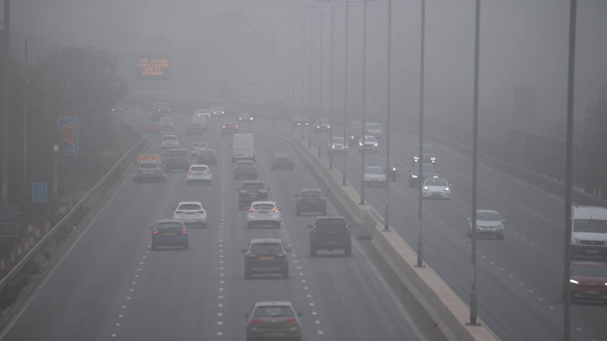
A yellow weather warning for dense fog has been issued across large parts of the country, threatening widespread disruption to travel.

- Core Development: A yellow weather warning for dense fog has been issued across large parts of the country, threatening widespread disruption to travel.
- Beat Context: Categorized under Transport with independent corroboration.
- Reporting Depth: 4 minute analytical read synthesized from verified newsroom sources.
Britain’s transport network faces severe disruption as a combination of long nights, clear skies, and light winds creates what forecasters describe as the perfect recipe
for dense fog, according to reporting by Yahoo News UK. The hazardous atmospheric conditions have prompted widespread warnings across large swaths of the country, affecting motorists, rail passengers, and air travellers alike.
The national weather agency issued a yellow weather warning that runs from Sunday, 8 November 2026 at 6pm until Monday, 9 November 2026 at 11am, as reported by the Mirror. The alert zone spans from York down to Bath, enveloping most of the South East and eastern England, where forecasters anticipate the thickest fog patches. Additional low-lying cloud and patchy fog are expected to reach Northern Ireland, parts of the West Country, and the central belt of Scotland.
Media additions


Niamh Murray, an operational meteorologist at the Met Office, explained the mechanics behind the phenomenon to the Press Association, as cited by the Border Telegraph.
"With autumn and winter and getting fog during this time of year, we get much longer nights, and that allows temperatures to sort of fall away. We get a longer period of cooling and also the temperatures are much lower, so they're much closer to the temperature that we need for the air to become saturated and therefore form fog. Another thing that we need to form fog is quite light winds, not absolutely no winds. We just have the perfect recipe at the moment: light winds, clear skies, long nights, to allow that fog to develop. And particularly if we see the negative numbers, it can quite stubborn to clear the next day."
Niamh Murray, Operational Meteorologist, via Border Telegraph
Rural parts of the Midlands, Wales, and East Anglia face particularly stubborn overnight conditions into Monday, with temperatures dipping near freezing and raising the prospect of air frost. Visibility in affected zones could plummet to 50 metres or less, creating treacherous conditions for drivers and compelling transport authorities to urge extra caution. Ground-level visibility is officially classified as fog when it drops below 1,000 metres, but dense fog reduces sightlines to under 100 metres.
Maritime and island transport has also been placed on alert. According to the Isle of Wight County Press, ferry services operating across The Solent face potential disruption, prompting operators to advise passengers to verify schedules prior to departure. Similar precautions apply to aviation, with the Met Office noting that air traffic controllers may be forced to increase aircraft separation distances during landings, thereby reducing airport capacity and increasing the risk of flight delays and cancellations.
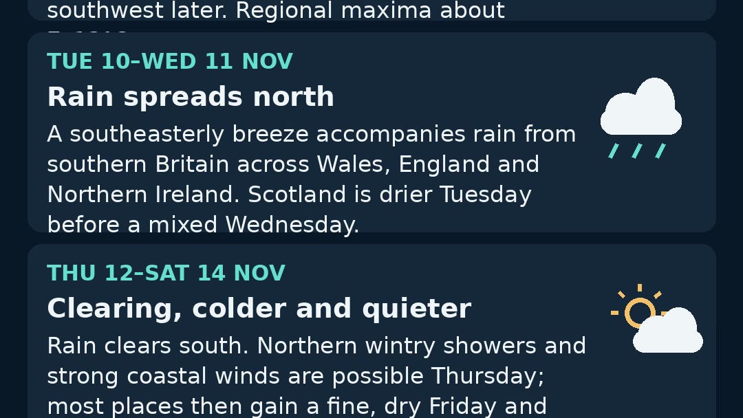
Complementary analysis from Observatory Analysis places the fog event within a broader weekly weather transition, noting that high pressure is beginning to yield to an Atlantic return that will bring rain and a strengthening breeze. Meanwhile, parallel disruptions have impacted northern transport arteries, where National Highways issued an Amber severe weather alert for strong winds across the North East, North West, and Yorkshire, as detailed by the West Bridgford Wire.
Further context on regional preparations comes from EDP24, which reported that Norfolk authorities advised motorists to check fog lights and allow extra journey time. In the West, The Western Telegraph highlighted that while South and West Wales avoided the direct warning polygon, adjacent areas such as Bristol and the Severn Bridge corridor remained vulnerable to knock-on transit delays.
Looking ahead, the foggy and settled conditions are expected to give way as a wetter Atlantic front moves across the country from Tuesday through Thursday. The Met Office forecasts general accumulations of 10mm to 20mm of rain, with some locations potentially receiving 30mm. In the South West—where severe drought remains enforced by the Environment Agency—slow-moving rain could deposit between 50mm and 70mm, providing much-needed relief to parched catchments.
Travellers are advised to monitor ongoing updates via Transport coverage and official weather portals as the week progresses, keeping a close eye on whether lingering morning mists prompt further yellow alerts from the Met Office.
How significant is this development?
Contribute your assessment to the aggregated reader sentiment ledger.
Frequently Asked Questions
Key questions answered in this reportWhat is the key development in: Met Office issues weather warning amid ‘perfect recipe’ for fog?
A yellow weather warning for dense fog has been issued across large parts of the country, threatening widespread disruption to travel.
Why is this Transport development significant for the UK?
This report covers critical events in our Transport beat. Independent reporting monitors related UK statements, regulatory shifts, and public responses as further verified details emerge.
How was this reporting corroborated and verified?
Newsarchy UK compiles and cross-references reporting from primary reporting from BBC and cross-checked wire reports. All coverage adheres to published editorial standards.
When was this report published?
This briefing was published on November 8, 2026 and is permanently cataloged in the Newsarchy UK Transport archives.