Met Office names 46 areas facing downpours on Wednesday - full list
Successive low-pressure waves are bringing heavy rain, strong winds, and changeable weather conditions to multiple regions across the UK.

- Core Development: Successive low-pressure waves are bringing heavy rain, strong winds, and changeable weather conditions to multiple regions across the UK.
- Beat Context: Categorized under Weather with independent corroboration.
- Reporting Depth: 4 minute analytical read synthesized from verified newsroom sources.
The United Kingdom faces a relentless spell of wet and windy weather as autumn takes hold, with meteorological authorities tracking successive waves of low pressure sweeping across the country according to Yahoo News UK. Following changeable conditions during the Bank Holiday weekend that brought thunder and yellow thunderstorm warnings, weather maps have turned blue to indicate widespread downpours affecting millions of residents from Scotland down to the Midlands and Wales.
The unsettled pattern continues a turbulent meteorological cycle that recently prompted authorities to issue multiple severe warnings. Previously, yellow thunderstorm warnings impacted dozens of areas throughout the UK as reported by Yahoo News UK, alerting the public to potential flooding and power cuts. Communities in the Perry Barr and Great Barr areas of Birmingham according to The Mirror have been continuing clean-up efforts following flooding caused by the first significant rainfall in several weeks. Those storms arrived after months of exceptionally dry and hot weather that officially pushed parts of England into drought, placing water levels under pressure and fueling wildfires including a major blaze on the Suffolk coast near Dunwich Heath that forced evacuations across more than 150 hectares of heathland as detailed by AOL.ca.
Media additions

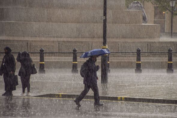
The progression of low-pressure bands has brought distinct conditions across different days of the week, moving from northern strongholds into southern regions. Meteorologist Kathryn Chalk noted that the end of Monday saw showers easing, leading to clear spells across England and Wales while showery outbreaks moved through Scotland and Northern Ireland reported The Mirror. Netweather.tv meteorologist Nick Finnis observed that Tuesday remained mostly dry and settled with variable cloud across England and Wales per The Mirror, while a cold front brought locally heavy and persistent rain sinking southwards across Scotland alongside scattered showers in Northern Ireland. Temperatures ranged widely, peaking at 24.6C in parts of Southeast England on Sunday before dipping toward 20C for most areas, and dropping as low as 15C in the far north of Scotland behind the front.
As the week progresses, the focus shifts to midweek and subsequent days. Gloucestershire and 45 other UK areas are set for downpours on Wednesday according to Yahoo News UK, with northern parts between Manchester and Glasgow potentially seeing the heaviest precipitation where maps turned orange and yellow. Met Office forecasts indicate that most affected English areas will experience at least 0.5mm to 1mm of rain per hour, whereas parts of Scotland, Northern Ireland, and Wales could endure up to 8mm of precipitation per hour. Looking further ahead, Met Office meteorologist Emma Salter warned that changeable conditions will persist, with a band of overnight rain moving south-eastwards to cover nearly the entirety of Wales by 5am on Thursday noted the Daily Express. That weather front is expected to extend as far south as Devon and Cornwall before lifting by midday, while northern regions experience heavy, blustery showers and potential coastal gales.
| Day | Primary Regions Affected | Rainfall Intensity / Notes |
|---|---|---|
| Monday | Scotland, northern England | 4mm to 8mm per hour in northern spots; England and Wales mostly dry (AOL.ca) |
| Tuesday | Scotland, Northern Ireland, sinking south | Locally heavy rain along a cold front; England and Wales mostly dry and settled (The Mirror) |
| Wednesday | Scotland, Midlands, Wales, northern England | 0.5mm to 1mm per hour in England; up to 8mm per hour in Scotland, Northern Ireland, and Wales (Yahoo News UK) |
| Thursday | Wales, South West England, Scotland, Northern Ireland | Rain clears southeastern England by early afternoon; strong winds and coastal gales possible (Daily Express) |
The broader meteorological outlook points to continued changeable conditions. According to the Met Office five-day forecast running from Wednesday through Friday, the nation will remain changeable with showers or longer spells of rain for most, punctuated by drier and brighter intervals reported Yahoo News UK. Temperatures are expected to remain near normal for early September, staying often mild by night although feeling cool in brisk winds noted the Daily Express. Further heavy rain may affect Northern Ireland, Scotland, northern England, and western Wales deeper into September according to Yahoo News UK.
How significant is this development?
Contribute your assessment to the aggregated reader sentiment ledger.
Frequently Asked Questions
Key questions answered in this reportWhat is the key development in: Met Office names 46 areas facing downpours on Wednesday - full list?
Successive low-pressure waves are bringing heavy rain, strong winds, and changeable weather conditions to multiple regions across the UK.
Why is this Weather development significant for the UK?
This report covers critical events in our Weather beat. Independent reporting monitors related UK statements, regulatory shifts, and public responses as further verified details emerge.
How was this reporting corroborated and verified?
Newsarchy UK compiles and cross-references reporting from primary reporting from Daily Express and cross-checked wire reports. All coverage adheres to published editorial standards.
When was this report published?
This briefing was published on September 17, 2026 and is permanently cataloged in the Newsarchy UK Weather archives.