Indonesia earthquake kills at least 20 and sparks mass evacuations
A shallow earthquake struck off the coast of Flores island in eastern Indonesia, triggering building collapses and tsunami warnings.
- Core Development: A shallow earthquake struck off the coast of Flores island in eastern Indonesia, triggering building collapses and tsunami warnings.
- Beat Context: Categorized under World with independent corroboration.
- Reporting Depth: 4 minute analytical read synthesized from verified newsroom sources.
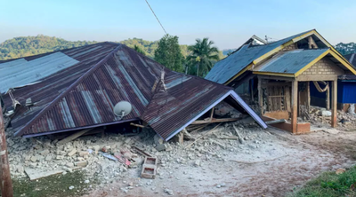
A powerful undersea earthquake struck off the coast of Flores island in eastern Indonesia early on Saturday, triggering widespread panic, building collapses, and mass evacuations to higher ground. The disaster has prompted urgent search and rescue operations across the mountainous region, with officials warning that the final casualty toll may rise as assessments continue in remote areas.
Reporting on the human cost varies among officials and agencies. According to Jacarandafm, rescue official Fathur Rahman stated from a boat in Nagekeo regency that at least 20 people were confirmed dead across four different towns, with six injured and two still buried under rubble. Meanwhile, Indonesia's Disaster Management Agency (BNPB) put the official confirmed death toll at 14, alongside two serious injuries. Regional figures cited by BBC noted fatalities across Sikka, Manggarai, and East Manggarai provinces. Emanuel Melkiades Laka Lena, governor of East Nusa Tenggara province, told a press conference that several victims were killed in their sleep by collapsing rubble, according to Theweek.
Media additions
The tremor struck shortly before 05:00 local time. Seismic monitoring networks recorded differing magnitudes for the initial jolt: the US Geological Survey and Indonesian authorities measured it at magnitude 7.7, while Geoscience Australia assessed it at 7.8. The epicentre was located just off the north coast of Flores, approximately 68 kilometres north-northwest of the coastal town of Ende in East Nusa Tenggara province, at a shallow depth ranging between 15 and 35 kilometres depending on the monitoring agency.
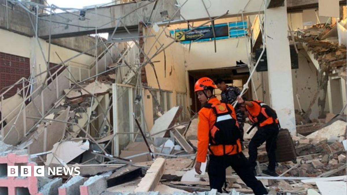
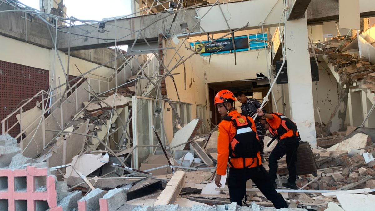
Shallow earthquakes tend to produce highly destructive surface effects. The shaking lasted for about a minute and was felt strongly across East Nusa Tenggara, West Nusa Tenggara, and as far away as South Sulawesi. Footage and eyewitness accounts described terrifying scenes as structures failed. At the port of Maumere, large chunks of concrete broke off the terminal building onto waiting passengers, and a ferry gangway collapse threw people into the sea. At St. Peter Major Seminary in Sikka, known locally as Ritapiret Seminary, students and nuns fled in panic as an assembly hall roof collapsed, with the rector reporting that a priest suffered a broken leg after jumping from a second-floor building.
Indonesia's Meteorology, Climatology, and Geophysics Agency (BMKG) issued an immediate tsunami warning after witnesses saw the sea retreat—a classic precursor to a tsunami. Coastal residents in Nagekeo and Sikka raced for the hills on foot, motorbikes, and pickup trucks. BNPB reported that roughly 2,000 residents self-evacuated. Tsunami waves measuring under one metre were recorded in several coastal areas. Authorities lifted the tsunami warning about three hours after the initial jolt once sea level monitoring indicated the immediate threat had passed. Australia's Tsunami Warning Centre confirmed there was no tsunami threat to the Australian mainland, islands, or territories.
The initial earthquake was followed by dozens of aftershocks. Geoscience Australia senior seismologist Jonathan Griffin noted that at least two aftershocks exceeded magnitude 6, including a 6.1 tremor, alongside multiple magnitude 5 tremors. The aftershocks and structural damage have compounded difficulties for emergency responders. Landslides have cut off several roads, and severe power outages combined with poor internet connectivity have severely hampered communications in remote areas, according to Remigius Jago, head of the Regional Disaster Management Agency (BPBD) in Nagekeo regency.
Impact and Emergency Response Overview
- Casualties: Between 14 and 20 fatalities reported by varying official and rescue sources; numerous injuries recorded.
- Infrastructure Damage: At least 54 houses severely damaged, alongside five healthcare facilities, three places of worship, six government buildings, educational institutions, warehouses, and port infrastructure.
- BNPB Deployments: Joint teams from the national search agency Basarnas, the military (TNI), police (Polri), and local agencies are conducting rapid assessments and deploying naval boats and aircraft.
- Evacuations: Approximately 2,000 residents evacuated to higher ground during the active tsunami warning.
The region remains highly vulnerable due to its geographic position. Indonesia sits along the Pacific "Ring of Fire," an arc of intense seismic and volcanic activity stretching from Japan through Southeast Asia. Historical memory in Flores remains scarred by a 7.7-magnitude earthquake in 1992 that generated a devastating tsunami, killing approximately 2,500 people.
Authorities have urged residents to remain calm, avoid damaged buildings that remain susceptible to collapse from ongoing aftershocks, and stay away from coastal areas. Emergency services continue rapid damage assessments across the mountainous terrain, and further updates on relief coordination are expected from disaster mitigation agencies.
For ongoing updates on regional developments, see World coverage.
How significant is this development?
Contribute your assessment to the aggregated reader sentiment ledger.
Frequently Asked Questions
Key questions answered in this reportWhat is the key development in: Indonesia earthquake kills at least 20 and sparks mass evacuations?
A shallow earthquake struck off the coast of Flores island in eastern Indonesia, triggering building collapses and tsunami warnings.
Why is this World development significant for the UK?
This report covers critical events in our World beat. Independent reporting monitors related UK statements, regulatory shifts, and public responses as further verified details emerge.
How was this reporting corroborated and verified?
Newsarchy UK compiles and cross-references reporting from primary reporting from abc.net.au and cross-checked wire reports. All coverage adheres to published editorial standards.
When was this report published?
This briefing was published on August 15, 2026 and is permanently cataloged in the Newsarchy UK World archives.