UK braces for coldest night of autumn as temperatures plunge
The UK is bracing for freezing conditions as an Arctic air mass sweeps across the country, bringing sub-zero temperatures and widespread frost. Health authorities have issued cold weather alerts as forecasters warn of hazardous driving conditions.
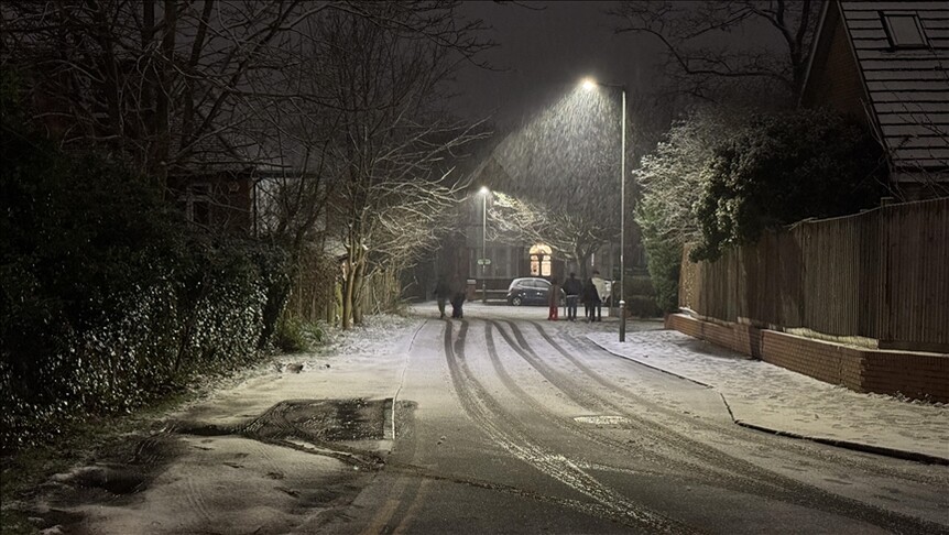
The UK is bracing for its coldest autumn night as Arctic air sweeps the nation, threatening widespread frost, treacherous driving conditions, and increased pressure on healthcare services.
As Anadolu Ajansı reports, the country is set to experience freezing conditions with widespread frost developing as temperatures plunge below zero. The sharp drop follows a period of fluctuating weather driven by Arctic air temporarily pushing southwards, while southern areas of the country have largely managed to retain milder Atlantic air.
Media additions


A northerly wind is driving the cold snap forward. According to the BBC, early cloud and rain in southern England will clear to leave a bright, sunny day for most, though wintry showers remain possible in Scotland. The far south of England may manage to escape the worst of the frost, staying slightly above freezing, but conditions elsewhere will deteriorate rapidly after dark.
Forecasters anticipate temperatures widely ranging between minus 1C and minus 5C from the Midlands northward. In rural parts of Scotland where snow is already lying on the ground, temperatures could plummet as low as minus 10C. This would surpass the previous seasonal low recorded at Tulloch Bridge in the Scottish Highlands, where the mercury dropped to minus 8.4C.
Despite the severity of the incoming chill, meteorologists emphasize that the conditions remain far from historic extremes. The BBC notes that the lowest November temperature on record stands at minus 16.1C, registered in Cumbria. A more recent low occurred when temperatures fell to minus 12.6C in Moray.
The Barry and District News highlights additional hazards posed by the plummeting temperatures, noting that freezing fog may form overnight in Northern Ireland, eastern England, and around the Solway Firth. Isolated patches of dense fog could also impact motorists further south.
| Location / Region | Forecast Low / Event | Context |
|---|---|---|
| Midlands northward | Minus 1C to minus 5C | Widespread frost expected widely |
| Rural Scotland | Minus 10C | Lying snow amplifying the cold |
| Scottish Highlands (Tulloch Bridge) | Minus 8.4C | Previous low of the season |
| Cumbria (Historical) | Minus 16.1C | Coldest November night on record (1912) |
Chief forecaster Matthew Lehnert warned via the Barry and District News about the incoming hazards, stating that patches of freezing fog could form overnight and create difficult conditions for travelers.
In response to the severe weather, health authorities have taken preventative action. Cold health alerts issued by the UK Health Security Agency remain in force across northern England, including the North West, North East, and Yorkshire and the Humber. While Anadolu Ajansı notes these alerts run until Monday morning, the Barry and District News specifies that the yellow alert will remain active until Tuesday morning. Officials warn that the conditions could result in an increased use of healthcare services and pose a greater risk to vulnerable populations.
Water levels are also causing concern alongside the drop in temperature. About a dozen flood alerts remained active across England following a preceding spell of wet weather, with the Environment Agency warning that local flooding from rivers and surface water remains possible.
Looking toward the weekend, the weather pattern shows signs of transition. Saturday will begin cold and frosty, giving way to largely dry and bright weather for most places. However, milder air, cloud, and rain are expected to edge back into south-west England by the end of the day. Sunday will bring further rain to south-west England, south Wales, and parts of Northern Ireland, while maximum temperatures over the weekend generally sit on the colder side of average.
Scientists have also monitored atmospheric phenomena high above the Arctic, where the polar vortex experienced an unusually early weakening. While such disruptions can sometimes lead to colder weather and snow weeks later, experts agree it is currently too soon for the vortex shift to influence UK weather, noting that the vortex has already begun recovering its normal strength.
As the cold front maintains its grip, residents in affected regions must prepare for hazardous driving conditions, localized fog, and continued low temperatures.