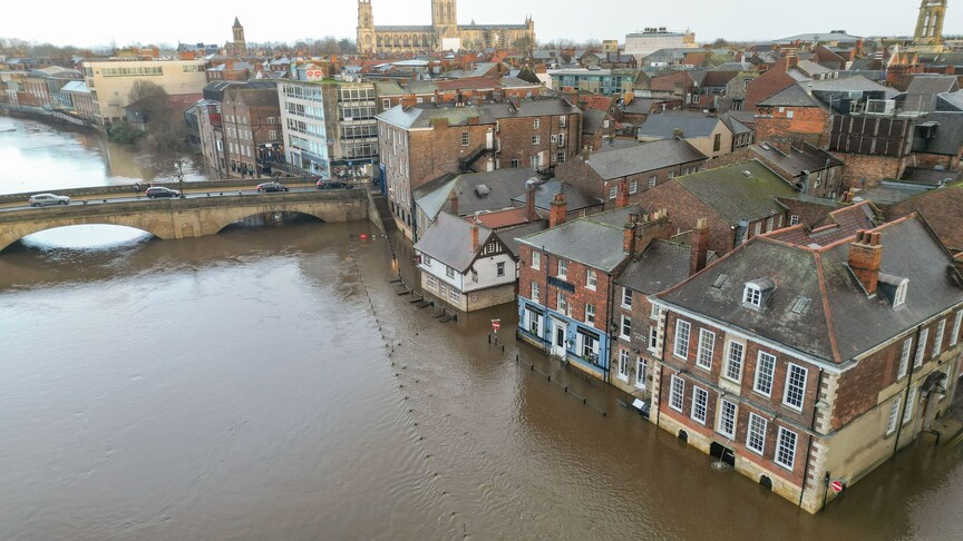
Storm Austen LIVE: Horror map shows huge 80mph gales to smash UK
Storm Austen has triggered rare amber wind warnings across parts of the UK, bringing torrential rain and gusts up to 80mph that disrupt travel networks.

- Core Development: Storm Austen has triggered rare amber wind warnings across parts of the UK, bringing torrential rain and gusts up to 80mph that disrupt travel networks.
- Beat Context: Categorized under Weather with independent corroboration.
- Reporting Depth: 3 minute analytical read synthesized from verified newsroom sources.
Britain is bracing for widespread disruption as Storm Austen sweeps in from the Atlantic, bringing torrential downpours and destructive winds that threaten travel networks, power supplies, and coastal communities.
According to Express reporting on Storm Austen, the brutal weather system is forecast to bring a spell of very strong winds and heavy rain across southern areas of the UK. The Met Office has issued a rare amber wind warning covering the whole of Cornwall, the Isles of Scilly, Plymouth, and parts of West Devon, valid from 1:00 am until 10:00 am on Friday. Wider yellow weather warnings for wind and rain are also in force across swathes of southern England, south Wales, the English Channel coast, and parts of Scotland.
Media additions


The system is expected to strengthen as it interacts with a powerful jet stream over the Atlantic, deepening to the south-west of the UK before moving through the English Channel. The Independent noted that satellite imagery tracked the storm sweeping towards the UK, prompting forecasters to warn of a "danger to life" from flying debris, large waves, and beach material thrown onto coastal roads.
| Storm System | Timing | Warning Level | Key Regions Affected | Peak Wind / Rain Estimates |
|---|---|---|---|---|
| Storm Austen | Late Thursday into Friday | Amber & Yellow | South-west England, Wales, southern England, Scotland | 60–70mph widely, up to 80mph in exposed headlands; up to 80mm rain in Scotland |
| Storm Boelo | Saturday 6:00 pm to Sunday | Yellow | Northern Ireland, Scotland, northern England | 55–65mph widely, up to 70–80mph in coastal spots |
As detailed by the Mirror, flood risks are compounding the severe weather threat, with numerous flood alerts active across England and Scotland. Particular concern surrounds the South Devon coast at Beesands, Torcross, Slapton, and Dawlish. Meanwhile, cities including Aberdeen, Dundee, and Edinburgh face significant downpours, with rainfall totals potentially reaching the equivalent of a month's worth for the Scottish capital.
The transport sector is already experiencing severe disruption. Guernsey airline Aurigny cancelled all flights to and from Southampton Airport after forecasts indicated winds would exceed operating limits with gusts reaching 60mph. In Wales, rail operators implemented precautionary timetable alterations on routes including the Heart of Wales line, the Cambrian line, and the North Wales Coast route. Chris Howchin, senior network delivery manager at Network Rail’s Wales and Borders route, explained that safety takes precedence, noting that strong winds can bring trees and debris onto the tracks while heavy rain causes flooding.
Emergency preparations are under way across multiple regions. Garth Smith, head of resilience at the British Red Cross, urged the public to secure loose outdoor items, check on vulnerable neighbours, and prepare household evacuation plans.
Relief will be short-lived once Storm Austen clears into the North Sea on Friday morning, as Aol and Met Office updates confirm that Storm Boelo is tracking closely behind. This second low-pressure system will impact the opposite end of the country over the weekend, bringing widespread gusts of 55 to 65mph—and up to 70 to 80mph in exposed coastal areas and high ground across Northern Ireland, Scotland, and northern England.
Residents in affected areas are advised to monitor ongoing weather coverage, keep updated through local authority guidance, and prepare for potential short-term interruptions to power, mobile phone coverage, and transport services as both storms run their course.
How significant is this development?
Contribute your assessment to the aggregated reader sentiment ledger.
Frequently Asked Questions
Key questions answered in this reportWhat is the key development in: Storm Austen LIVE: Horror map shows huge 80mph gales to smash UK?
Storm Austen has triggered rare amber wind warnings across parts of the UK, bringing torrential rain and gusts up to 80mph that disrupt travel networks.
Why is this Weather development significant for the UK?
This report covers critical events in our Weather beat. Independent reporting monitors related UK statements, regulatory shifts, and public responses as further verified details emerge.
How was this reporting corroborated and verified?
Newsarchy UK compiles and cross-references reporting from primary reporting from express.co.uk and cross-checked wire reports. All coverage adheres to published editorial standards.
When was this report published?
This briefing was published on October 22, 2026 and is permanently cataloged in the Newsarchy UK Weather archives.