Southeast coastal storm threatens Thanksgiving travel as potential Subtropical Kyle forms
A persistent coastal weather system off the Southeast United States is gathering strength, threatening to disrupt early holiday journeys across the region.
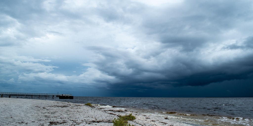
A brewing Southeast coastal storm threatens early holiday travel as forecasters monitor the potential formation of Subtropical Kyle.
Millions of travellers face mounting uncertainty as a persistent coastal weather system off the Southeast United States gathers strength, threatening to disrupt early holiday journeys across the region. According to FOX Weather, the National Hurricane Center has designated the area off the Southeast coast as an area to watch for tropical development. The system could become a rare late-season named tropical storm as low pressure develops off the coast of Florida and gradually begins to intensify, with computer forecast models showing growing consensus that a storm will form off the coast over the weekend.
Media additions



This developing low-pressure disturbance follows days of torrential downpours that inundated Florida. As reported by WPTV, heavy rains and strong winds prompted a flood watch across the Treasure Coast and Palm Beaches, where communities braced for intense precipitation. The Weather Prediction Center issued a Level 2 out of 4 flash flood risk spanning South Carolina, Georgia, and northeastern Florida from Saturday into early Sunday morning.
Forecasters are tracking multiple scenarios for the storm's progression. According to WMBF, a track into coastal South Carolina would bring the most significant impacts with heavy rain, strong winds and coastal flooding. Conversely, a track just offshore and into eastern North Carolina would deliver rain and gusty winds to the area, along with minor coastal flooding and erosion, while a track well offshore would keep the area mostly cloudy with just some occasional light rain. Wind gusts along the Grand Strand are likely to reach 30 to 40 mph late Saturday into Sunday, with gusts across the Pee Dee reaching 20 to 30 mph.
Regional Impacts and Weather Variations
The unfolding atmospheric disruption extends far beyond the American coastline. Weather systems globally are generating severe disruptions. In South Asia, the India Meteorological Department reported that Cyclonic Storm Akvan intensified over the Bay of Bengal, threatening Andhra Pradesh and Odisha with destructive winds and torrential rains. Kuehne+Nagel noted that Akvan strengthened into a severe cyclonic storm moving towards India's east coast, with maximum sustained wind speeds forecast at 100–110 km/h and gusts reaching 120 km/h ahead of a landfall forecast around noon on Thursday, 20 November 2026. Meanwhile, Jagran Josh reported that northern India experienced dense morning fogs and sharp winter chills on Thursday, 19 November 2026.
Simultaneously, western North America faced its own moisture-laden systems. 10news reported that San Diego absorbed soaking rains, mountain snow dustings, and powerful coastal surf warnings, with a stronger storm bringing heavier rain and mountain snow by Friday morning. Across the Atlantic, European authorities issued localized alerts, including a yellow warning for high waves along the Alpes-Maritimes coast from Météo-France, as documented by Riviera Radio, effective from Tuesday, 17 November 2026, until Wednesday, 18 November 2026, with gusts reaching up to 60 km/h.
| Region | Primary Hazard | Forecast Window | Key Risk Factor |
|---|---|---|---|
| Southeast US Coast | Potential Subtropical Kyle / Heavy Rain | Weekend into early next week | Flash flooding, high surf, travel delays |
| Florida Atlantic Coast | Prolonged Heavy Rainfall | Tuesday through Friday | Street flooding, poor drainage, rip currents |
| Andhra Pradesh, India | Severe Cyclonic Storm Akvan | Landfall around Thursday noon | 100–120 km/h winds, torrential downpours |
| San Diego County | Cold Atmospheric Front | Thursday into Friday | Mountain snow, gusty winds, high surf |
| Alpes-Maritimes, France | High Waves and Coastal Flooding | Tuesday evening to Wednesday midday | Strong gusts up to 60 km/h, rough seas |
Specialist agencies continue to emphasize the importance of preparedness. The Met Office highlighted the critical role of tailored marine and mountain forecasts in mitigating extreme environmental risks. Concurrently, the National Weather Service maintained continuous coastal and high-seas watch updates across mainland continental US waters.
What to Watch Next
- Monitor official National Hurricane Center bulletins for track updates regarding potential Subtropical Kyle.
- Check local transport advisories before embarking on holiday journeys across the Southeast US.
- Observe local flood watches, high surf advisories, and marine warnings issued by regional weather forecasting offices.
For ongoing updates on atmospheric disturbances and regional forecasts, consult our dedicated Weather coverage.