Environment Agency issues 52 flood warnings as Storm Herminia brings rain
Storm Herminia is causing significant disruption across the UK, with numerous flood warnings in place and heavy rainfall expected to continue through the week.
- Core Development: Storm Herminia is causing significant disruption across the UK, with numerous flood warnings in place and heavy rainfall expected to continue through the week.
- Beat Context: Categorized under Weather with independent corroboration.
- Reporting Depth: 3 minute analytical read synthesized from verified newsroom sources.
The Environment Agency has issued 52 red flood warnings, alongside an additional 172 flood alerts. These measures, in effect as of 6.45am today, primarily impact central and southern England as the nation experiences the effects of Storm Herminia.
This latest low-pressure system arrived following the impact of Storm Eowyn, which caused widespread disruption across the country last Friday. While Storm Herminia is noted as less powerful than its predecessor, its arrival has brought sustained downpours and fierce, gusty winds to much of the United Kingdom.
Media additions
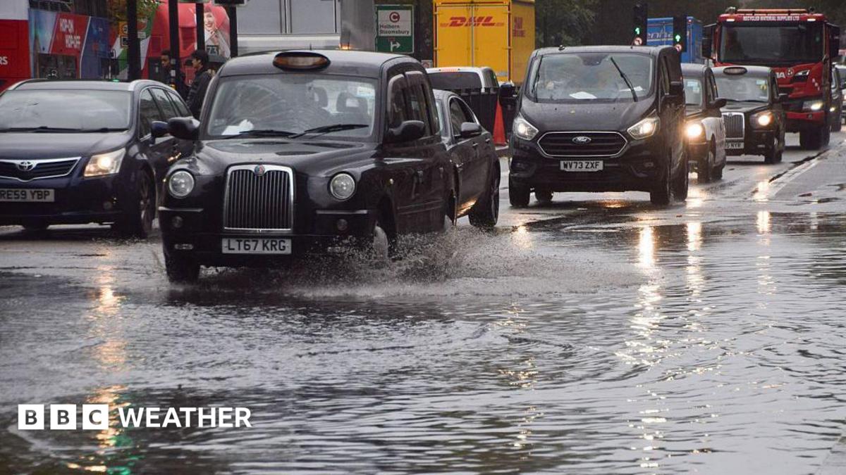
Current weather impacts
The intensity of the current weather has been marked by significant wind speeds and precipitation. Meteorologists recorded gusts reaching 83mph at Berry Head in south Devon, while Capelcurig in North Wales saw wind speeds of 81mph. Precipitation has been equally notable; Okehampton in Devon recorded 35.8mm of rain on Sunday. The Met Office anticipates that rainfall totals could reach 20mm to 40mm widely, with higher ground potentially seeing 50mm to 70mm.
The Environment Agency has warned that these conditions pose risks to infrastructure. Ben Lukey, a flood duty manager at the Environment Agency, outlined the potential for damage:
"Although not expected, impacts could include localised flooding from watercourses, drains, channels and flooding from overland flow."
The physical impact of the storms has necessitated closures on several major transport routes. In Devon and Wiltshire, stretches of the A36 and A303 were closed due to flooding. In Scotland, where recovery from Storm Eowyn remains an ongoing priority, engineers have been working to clear debris from lines. The Largs to Adrossan line will not reopen on Monday after an overhead gantry was brough down by a falling tree. While some services between Glasgow and Edinburgh resumed, operators have cautioned passengers to expect potential delays and late starts.
Power networks are also working to restore service to those affected by the initial storm. At the conclusion of Sunday, Northern Ireland Electricity Networks reported that approximately 74,000 customers remained without power, while Northern Powergrid continued efforts to reconnect more than 150 customers.
Forecast and outlook
The weather remains unsettled as the week progresses. The Met Office has issued multiple yellow weather warnings for rain and wind. For parts of southwest England, a warning remains in place until 23:59GMT Wednesday, with the potential for rainfall totals to reach 60mm to 80mm over the moors. Similar warnings cover south Wales, where rainfall is expected to be between 15mm and 25mm, potentially rising to 40mm over south-facing hills.
Beyond the immediate rainfall, a significant shift in temperature is expected. While temperatures have remained above average, a transition is forecast as Arctic air moves southward. By Thursday, this cold air is expected to feed into Scotland, where maximum temperatures may hover around 6C. The collision of this cold air with a rain-bearing weather system creates the potential for snow on the high ground of Scotland on Thursday. By the end of the week, the colder air is expected to extend into Northern Ireland and northern England, with temperatures likely to remain in single figures. This transition is expected to cover the entire United Kingdom by Monday, with predicted maximum temperatures ranging from 4C in the north to 9C in the south.
Authorities continue to monitor the situation through the Flood Forecasting Centre, a collaboration between the Environment Agency and the Met Office. Residents are advised to consult updated resources, including the five-day flood outlook for England and Wales, as further heavy rain through the end of the week may result in the issuance of additional weather warnings.
How significant is this development?
Contribute your assessment to the aggregated reader sentiment ledger.
Frequently Asked Questions
Key questions answered in this reportWhat is the key development in: Environment Agency issues 52 flood warnings as Storm Herminia brings rain?
Storm Herminia is causing significant disruption across the UK, with numerous flood warnings in place and heavy rainfall expected to continue through the week.
Why is this Weather development significant for the UK?
This report covers critical events in our Weather beat. Independent reporting monitors related UK statements, regulatory shifts, and public responses as further verified details emerge.
How was this reporting corroborated and verified?
Newsarchy UK compiles and cross-references reporting from primary reporting from bbc.com and cross-checked wire reports. All coverage adheres to published editorial standards.
When was this report published?
This briefing was published on July 13, 2026 and is permanently cataloged in the Newsarchy UK Weather archives.


