Met Office issues heatwave warning as 'heat domes' bring 5C change ...
A heat dome is triggering a heatwave warning across southern England and Wales, with both land and sea temperatures reaching levels that threaten infrastructure.

- Core Development: A heat dome is triggering a heatwave warning across southern England and Wales, with both land and sea temperatures reaching levels that threaten infrastructure.
- Beat Context: Categorized under News with independent corroboration.
- Reporting Depth: 4 minute analytical read synthesized from verified newsroom sources.
Met Office issues heatwave warning as ‘heat domes’ bring 5C change …
The Met Office has warned that a “heat dome” now hovering over western Europe is pushing sea‑surface temperatures 4‑5 °C above normal off eastern and southern England. The twin threats of scorching air and scorching seas mean the heat will linger, strain infrastructure and could trigger unprecedented marine die‑offs.
Heat on land – a record‑breaking spell
The warning, which runs from 9 am on Wednesday to 9 pm on Thursday, covers an area stretching from London to Swansea and from Somerset to Birmingham. The Daily Mail reports that the heat could reach “up to 40 °C” in parts of central and southern England, matching the all‑time UK record of 40.3 °C set in July 2022.
Media additions
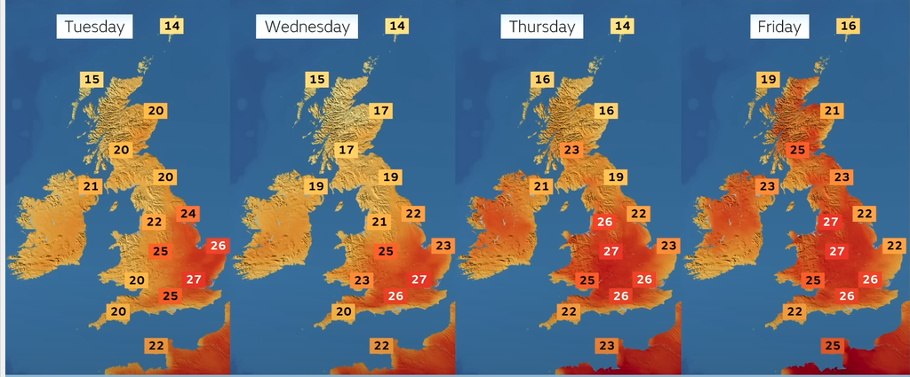
The UK Health Security Agency (UKHSA) has upgraded its heat‑health alerts to red for the same period, signalling “increased risk to life across the whole population”.
The heat dome is also keeping nights unusually warm. Meteorologists expect “tropical nights” – when temperatures do not fall below 20 °C – to persist, exacerbating sleep deprivation and heat stress for residents even after the sun sets.
Marine heatwave – the third and most intense of the year
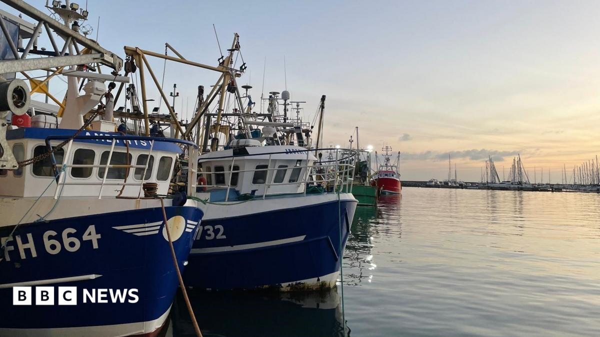
At the same time, the Met Office has sounded a marine heatwave warning for the same region. Dr Ségolène Berthou, an air‑sea interaction specialist at the Met Office, told the Express that “marine heatwaves around the UK have developed rapidly following the recent heat dome” and that “this is the third and most intense marine heatwave we have seen this year”. She added that the warm seas “reduced night‑time cooling and helped sustain warmth, particularly in coastal areas”.
The Copernicus Climate Change Service and the Copernicus Marine Service confirmed that global sea‑surface temperatures have surpassed the previous seasonal records set in 2023 and 2024. According to the Bbc’s coverage, “small pockets off the coast of Brittany had entered ‘extreme’ marine heatwave conditions as of Tuesday”, and the situation is expected to intensify over the next few days.
“We’re starting to see temperatures now that we would expect to see at the height of summer, [at the] end of August,”
Dr Zoe Jacobs, National Oceanography Centre, via BBC
The shallow nature of the English Channel and southern North Sea means heat penetrates quickly, threatening seagrasses, kelp forests and other cool‑water habitats that “can experience high levels of heat stress when temperatures surge”, according to the BBC.
Researchers warn that mass die‑offs of seagrasses and shellfish could cascade through the food web. Prof Matt Frost of Plymouth Marine Laboratory explained that “we’re seeing a decline in the numbers of cod and other key species… you’re also getting other species that could displace native species”. Warmer waters have already attracted octopus to south‑west England, a change that may open new markets but also “hit populations of crabs, lobster, scallops and other shellfish on which they prey”, Frost added.
Infrastructure and everyday life under strain
The Daily Mail notes that “schools could shut amid fears over the impact of overheating classrooms on children’s health”.
Train operators have introduced speed restrictions and temporary service alterations because “overhead lines expand and sag and rails buckle” in the heat, as detailed by the Daily Mail.
Even horse racing has felt the squeeze. The British Horseracing Authority abandoned four meetings.
What the science says – and what may come
Long‑term trends provide context for the current crisis. The Met Office deep‑dive blog explains that the heat dome’s air mass originated over Labrador, descended and warmed adiabatically, then moved eastward under high pressure, creating the “perfect recipe for high temperatures”. That same post notes that “the UK’s seas have been getting steadily warmer since the 1980s, driven by human‑caused climate change”.
Professor Stephen Belcher, the Met Office chief scientist, warned that “extreme heatwaves like this are set to become ‘more likely and more intense’”, with a plausible “2056 scenario” suggesting the UK could see temperatures of 45 °C under 2.5 °C of global warming. He added that “average UK summers have warmed by around 1.4 °C” since 1976, and “extremes have changed too”.
Reader‑facing aid – timeline of the heat event
- Tuesday — Copernicus services flag “extreme” marine heatwave pockets off Brittany.
- Wednesday — Met Office issues red extreme‑heat warning for central/southern England and Wales (9 am–9 pm).
- Wednesday, UKHSA upgrades health alert to red; schools begin early closures.
What to watch next
For now, the Met Office urges the public to stay hydrated, avoid strenuous activity between 11 am and 3 pm, and check the latest forecasts on its website.
How significant is this development?
Contribute your assessment to the aggregated reader sentiment ledger.
Frequently Asked Questions
Key questions answered in this reportWhat is the key development in: Met Office issues heatwave warning as 'heat domes' bring 5C change ...?
A heat dome is triggering a heatwave warning across southern England and Wales, with both land and sea temperatures reaching levels that threaten infrastructure.
Why is this News development significant for the UK?
This report covers critical events in our News beat. Independent reporting monitors related UK statements, regulatory shifts, and public responses as further verified details emerge.
How was this reporting corroborated and verified?
Newsarchy UK compiles and cross-references reporting from primary reporting from dailymail.com and cross-checked wire reports. All coverage adheres to published editorial standards.
When was this report published?
This briefing was published on July 9, 2026 and is permanently cataloged in the Newsarchy UK News archives.