Met Office issues yellow weather warnings for heavy rain and strong winds
The UK faces potential disruption as a low-pressure system brings heavy rainfall and strong winds to parts of England, Scotland, and Northern Ireland. The Met Office warns of possible flooding and travel delays as the weather front moves across the country.
Met Office issues yellow weather warnings for heavy rain and strong winds
The United Kingdom is bracing for a significant shift in weather conditions as a series of yellow weather warnings have been issued across the country. Following a period of mild temperatures and relatively dry conditions, the Met Office has signalled that a low-pressure system moving in from the Atlantic is set to bring heavy, persistent rainfall and strong gusty winds to wide areas of the nation.
The transition marks a departure from the summer heat that preceded the current warnings. As noted by the Met Office, the situation remains fluid, and the national weather service has issued a clear directive to the public:
"Be prepared for weather warnings to change quickly: when a weather warning is issued, the Met Office recommends staying up to date with the weather forecast in your area."
Media additions
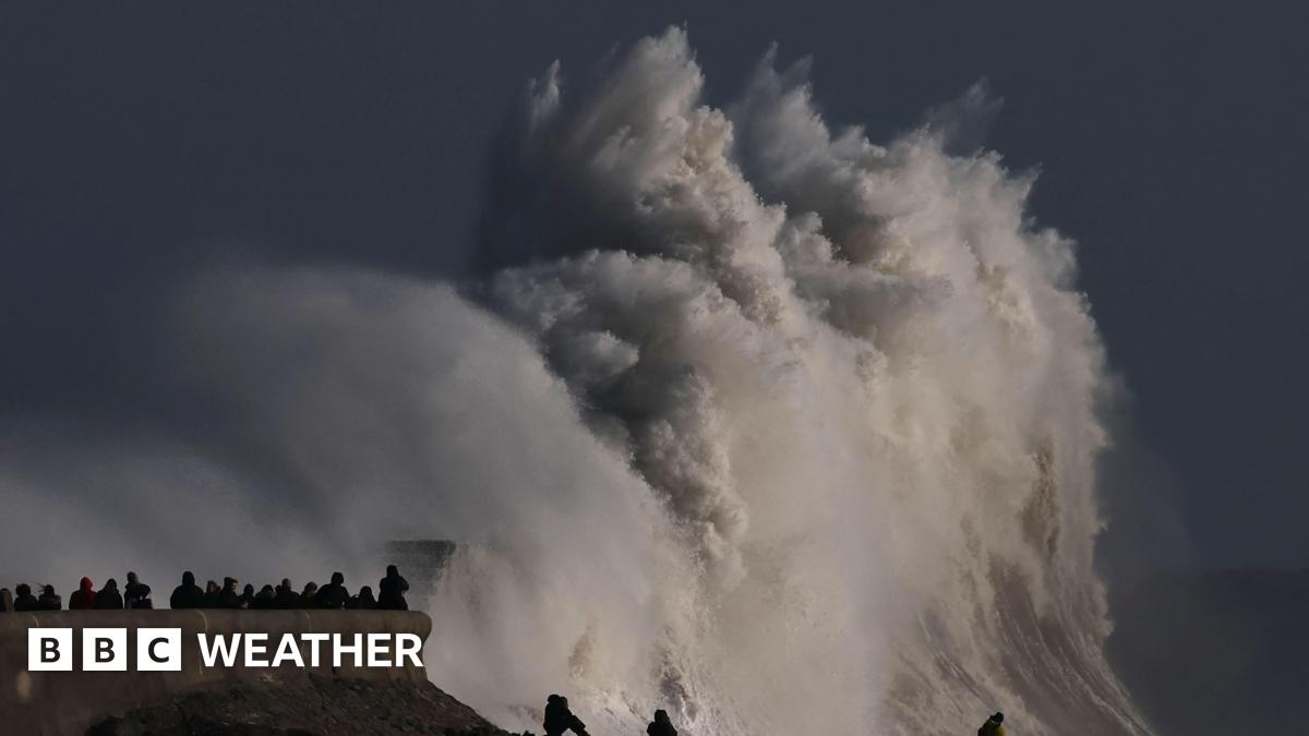
Image via mirror.co.ukImage via newswav.comImage via uk.news.yahoo.com
Met Office, via Independent
Areas at Risk
The impact of the incoming weather front is widespread, with specific alerts covering large portions of the UK. According to reports, the regions currently under observation for heavy rainfall and wind include:
Northeast England
Northwest England
Southwest Scotland
Strathclyde
Yorkshire and Humber
Central, Tayside and Fife
Northern Ireland
In Northern Ireland, specifically in County Antrim and County Down, rainfall totals are anticipated to be significant between midday on Saturday and 3am on Sunday. Meteorological experts have indicated that while widespread rainfall is expected to range between 20 and 40mm, certain areas could see totals climbing toward 100mm.
Potential Impacts
The Met Office weather warning system categorises the current yellow alerts as having a medium impact but a very low likelihood. However, the potential for disruption remains a primary concern for local authorities and emergency services. Potential consequences of the deluge include:
Flooding of homes and businesses
Disruption to road, rail, and bus travel
Localized power cuts
A small chance of fast-flowing or deep water creating a danger to life
Further details provided by Met Office Chief Meteorologist Matthew Lehnert suggest that wind speeds will be a compounding factor. While not all areas will experience extreme wind, inland locations could see gusts between 50 and 60 mph, while coastal areas may face gusts reaching 65 to 75 mph. The strongest winds are expected to migrate from the Bristol Channel and west Wales coast toward the North Sea coast of east and northeast England by early Sunday morning.
Flood Preparedness
The Environment Agency has been monitoring the situation closely. Residents in affected areas have been advised to consider preparing flood plans and emergency kits. Those driving are encouraged to check road conditions and travel timetables before setting out, as the Metro reports that flooding of both homes and local businesses is possible.
What to Watch Next
Looking at the forecast for the remainder of the weekend and into next week, meteorologists anticipate a gradual easing of the most intense rain. Persistent heavy rainfall is expected to clear from Wales in the early hours of Sunday, while northern England and Scotland should see relief by dawn.
Despite the clearing rain, the coming week is expected to feel cooler, with temperatures in many areas falling below the seasonal average. Those planning outdoor activities or travel should stay alert for potential updates to these warnings, as confidence in rainfall totals for specific urban areas remains under constant review by the forecasting teams.