Met Office issues yellow warnings for 15 Welsh areas, urging emergency kits
The Met Office issued yellow weather warnings across 15 Welsh counties for heavy rain, with up to 70 mm possible in some areas. Residents are advised to prepare emergency kits and review flood plans.

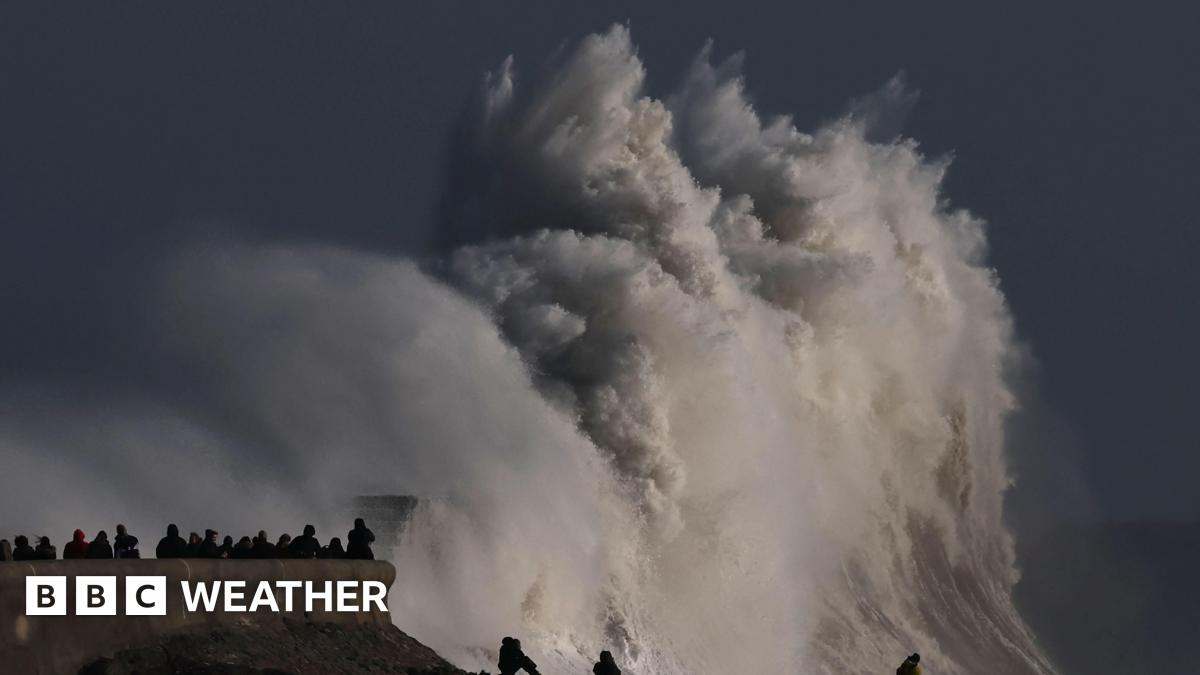
The Met Office threw a yellow weather warning across 15 Welsh counties on 20 September 2025, flagging up‑to‑70 mm of rain in some locations within hours. The alert comes as a deepening low‑pressure system drives intense rain showers, raising immediate concerns about flooding, power cuts and disrupted travel. Residents in the affected zones are being told to assemble emergency kits and review flood plans before the storm hits.
Two separate warnings were released. The first, covering southwest Wales, runs from 6:00 am to 11:00 pm. The second, for northwest Wales, is in force from 3:00 am to 12:00 pm. Both warnings are classified as “yellow”, the Met Office’s alert level for situations that could cause moderate disruption if conditions worsen.
Media additions


What the warnings cover
- Southwest Wales (6 am–11 pm): Cardiff, Tenby, Merthyr Tydfil and the counties of Blaenau Gwent, Bridgend, Caerphilly, Carmarthenshire, Neath Port Talbot, Powys, Rhondda Cynon Taf, Swansea and Vale of Glamorgan. Forecast rain totals range from 30 mm to 40 mm, with isolated “up to 70 mm” pockets.
- Northwest Wales (3 am–12 pm): Ceredigion, Conwy, Gwynedd and Powys. Expected rainfall is broadly 30 mm to 40 mm, with “some spots potentially seeing 50 mm to 60 mm in just six hours”.
These figures echo the details reported by Ibtimes UK and corroborated by Inkl. Both outlets note that the rain “could be persistent and, at times, heavy throughout the day”.
Official advice from the Met Office
On its website the Met Office urges households in the warning area to “put together emergency flood kits and develop a flood plan if they live in an at‑risk area”. The suggested kit should contain torches, batteries, a power bank for mobile phones and other essential supplies. The agency also reminds people to verify whether their property lies within a flood‑risk zone and to stay informed of local forecasts.
“Be prepared for weather warnings to change quickly: when a weather warning is issued, the Met Office recommends staying up to date with the weather forecast in your area,”
Met Office, online statement, via The News
Emergency services, the Environment Agency and Natural Resources Wales are on standby, ready to issue separate flood alerts if river levels rise.
Why the heavy rain is arriving now
Both the Ibtimes and Inkl pieces link the surge in rainfall to “shifting weather systems” and a “change in the jet stream” that is set to bring “more unsettled weather and a noticeable drop in temperatures, particularly across northern parts of the UK”. The same analysis appears in the Met Office’s own climate commentary, which notes that “outbreaks of rain in the northwest” are expected as the season transitions into meteorological autumn.
In the broader UK context, Manchester Evening News reports that the yellow rain warning for parts of Wales is part of a suite of warnings covering the south of England, Scotland and the Midlands. The outlet highlights that the UK just experienced its warmest summer on record, an anomaly that may be amplifying the intensity of the ensuing autumn showers.
Adding to the picture, Mirror quotes a Met Office spokesperson: “An area of rain, heavy in places, will move northwards across northern England overnight before slowly decaying over southern Scotland Thursday morning.” While the quote focuses on northern England, it underscores the scale of the moisture‑laden system that is also feeding the Welsh warnings.
Potential impacts on the ground
Urban centres such as Cardiff, Swansea and Neath Port Talbot are likely to experience drainage strain, according to the agency’s assessment. Rural and hilly terrain in Powys and Gwynedd could see rapid surface runoff, raising flash‑flood risks for communities near rivers or low‑lying fields. Power cuts are a distinct possibility where water ingress reaches underground infrastructure.
Transport networks could feel the knock‑on effect. Roads, rail services and footpaths are expected to face “localised flooding and travel disruption”, especially during peak commuting hours. The Thenews report flags “strong thunderstorms” and “gales around the Irish Sea coasts” that may further impede movement.
What to pack in your emergency kit
- Torches and spare batteries
- Power bank for mobile devices
Residents are also urged to check Met Office forecasts throughout the day and to follow guidance from local councils and the Environment Agency.
What to watch next
| Time | Event | Expected Development |
|---|---|---|
| 20 Sep 2025 03:00–12:00 | Northwest Wales yellow warning | 30–40 mm rain, possible 50–60 mm bursts |
| 20 Sep 2025 06:00–23:00 | Southwest Wales yellow warning | 30–40 mm rain, isolated up to 70 mm |
| 20 Sep 2025 evening | Potential power cuts & localised flooding | Emergency services on standby |
| 21 Sep 2025 overnight | Jet‑stream shift | Colder, wetter conditions spread northwards; snow possible in Scotland |
The Met Office says it will continue to monitor the situation and issue further alerts if rainfall intensifies or additional hazards, such as thunderstorms, develop. Residents should keep an eye on updates from the agency and local authorities until the warnings lapse later on 20 September.
For ongoing coverage of this developing story, see our weather section and the dedicated page on the Met Office’s UK weather warnings.