Extreme Heat Warning extended as temperatures forecast to reach 38°C
The Met Office has extended record-breaking heat warnings across parts of the UK as humidity and tropical nights create severe public health and infrastructure risks.

- Core Development: The Met Office has extended record-breaking heat warnings across parts of the UK as humidity and tropical nights create severe public health and infrastructure risks.
- Beat Context: Categorized under Weather with independent corroboration.
- Reporting Depth: 3 minute analytical read synthesized from verified newsroom sources.
Heatwave stretches into the weekend and beyond
The Met Office has kept its amber extreme‑heat warning in place for eastern England, the south‑east and parts of the Midlands until 09:00 BST on Sunday 28 June. The red alert, first issued on Thursday 24 June, has been extended until 21:00 BST on Friday 26 June, marking the first three‑day run of a red warning since the system was introduced.
Temperature trajectory and humidity
Humidity will amplify the heat. Dew points are forecast around 22 °C on Wednesday and Thursday, a stark contrast to the single‑digit dew points recorded during the July 2022 heatwave. The Met Office warns that such moisture “makes it difficult for the body to cool itself through sweating”.
Media additions

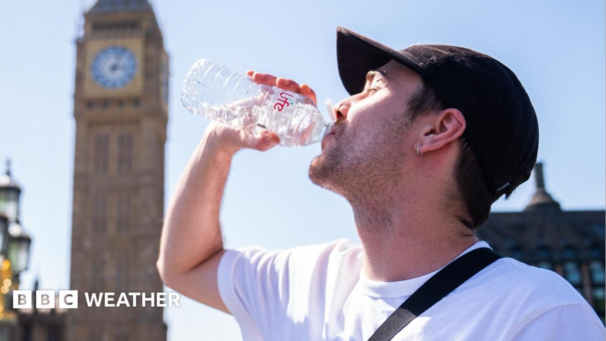

“The forecast heatwave is developing into an impactful severe weather event, with record breaking June temperatures and very high humidity. The combination of heat and humidity will be oppressive and bring impacts across society from public health and infrastructure, to power and water supplies.
“As well as very high daytime temperatures, there will be consecutive nights where temperatures do not drop below 20°C, which is called a Tropical Night. This will make it very hard for people to recover from the daytime heat, exacerbating the heat stress impacts.”
Tom Crabtree, Deputy Chief Forecaster, via Met Office
Health alerts and vulnerable groups
The UK Health Security Agency (UKHSA) has issued amber and yellow heat‑health alerts for the same regions. The agency stresses that the high temperatures could increase deaths among older people and those with long‑term conditions, and that hospitals may see a surge in heat‑related emergencies. Water safety concerns are also highlighted. Samantha Hughes, the RNLI’s national water safety partner, reminded the public that “the water is still cold” and warned of cold‑water shock for anyone entering lakes, rivers or the sea unexpectedly.
Transport, power and infrastructure at risk
The amber warning explicitly mentions “potential travel disruption” and “welfare issues for those stuck on roads, trains and planes”. London’s tube, rail and bus networks have already been flagged for possible service interruptions, with heat‑sensitive equipment at risk of failure.
Power supplies could be strained as equipment overheats. The Met Office notes an “increased likelihood of power outages” alongside the broader warning that “equipment starts to fail in the heat”.
Record‑breaking temperatures and tropical nights
June’s temperature record of 35.6 °C, set jointly in Southampton (1976) and Camden Square (1957), is under threat. Met Office data shows a provisional peak of 36.1 °C in Gosport, Hampshire on Wednesday 24 June, with forecasts suggesting “some daytime maximum temperatures could exceed 36 °C, perhaps rising to 37 °C in some locations”, according to Chief Meteorologist Andy Page.
The same day saw “the warmest June night on record” in Cardiff, where overnight temperatures did not fall below 23.5 °C.
Overnight temperatures will remain high, with “tropical nights” – where the temperature does not drop below 20 °C – expected across urban areas of southern England on Wednesday, Thursday and into the weekend. These nights limit recovery from daytime heat, increasing the risk of heat‑stress related illnesses.
Regional variations and the coming change
While southeast England endures the worst of the heat, the northwest is set to see cooler, cloudier conditions. Thunderstorms are forecast for Monday and Tuesday, with isolated heavy downpours and hail threatening localized disruption.
Preparedness advice and next steps
The Met Office urges the public to stay “WeatherReady”, avoiding outdoor exercise between 11:00 and 15:00, drinking plenty of fluids, wearing sunscreen and staying in the shade. The agency has added beach forecasts with tide times, wave heights and sea‑surface temperatures to its app, and highlighted the risk of water‑related incidents as more people visit coasts and inland waterways.
How significant is this development?
Contribute your assessment to the aggregated reader sentiment ledger.
Frequently Asked Questions
Key questions answered in this reportWhat is the key development in: Extreme Heat Warning extended as temperatures forecast to reach 38°C?
The Met Office has extended record-breaking heat warnings across parts of the UK as humidity and tropical nights create severe public health and infrastructure risks.
Why is this Weather development significant for the UK?
This report covers critical events in our Weather beat. Independent reporting monitors related UK statements, regulatory shifts, and public responses as further verified details emerge.
How was this reporting corroborated and verified?
Newsarchy UK compiles and cross-references reporting from primary reporting from metoffice.gov.uk and cross-checked wire reports. All coverage adheres to published editorial standards.
When was this report published?
This briefing was published on July 17, 2026 and is permanently cataloged in the Newsarchy UK Weather archives.


