Met Office issues yellow wind and rain
The Met Office has issued yellow weather warnings as a shift in the UK's weather pattern brings heavy rain, strong gusts, and potential travel disruption.

- Core Development: The Met Office has issued yellow weather warnings as a shift in the UK's weather pattern brings heavy rain, strong gusts, and potential travel disruption.
- Beat Context: Categorized under Weather with independent corroboration.
- Reporting Depth: 4 minute analytical read synthesized from verified newsroom sources.
Britain’s weather regime has flipped from a cold easterly pattern to a milder westerly flow, ushering in a spell of heavy rain and strong gusts that have triggered yellow warnings across large parts of the country. The shift matters because the Met Office warns of travel disruption, coastal hazards and the possibility of power cuts as the wind and rain intensify from Thursday into the weekend.
Deputy Chief Meteorologist Mike Silverstone explained that “the weather will be turning milder for much of the country from Thursday, but this transition heralds the start of some potentially more impactful wind and rain.” He added that Friday could bring “the strongest winds, possibly around 70 mph on exposed coasts and around 60 mph more widely within the warning areas” and “30‑40 mm likely in parts of Scotland” with “up to around 70 mm possible over higher ground.”
Media additions
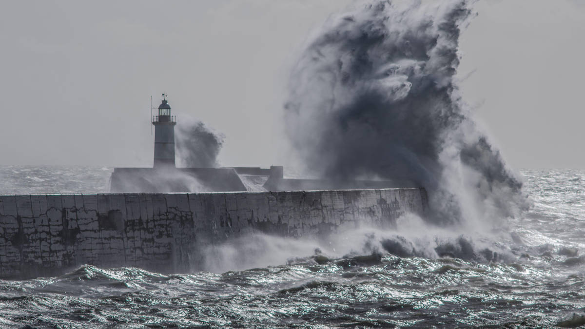
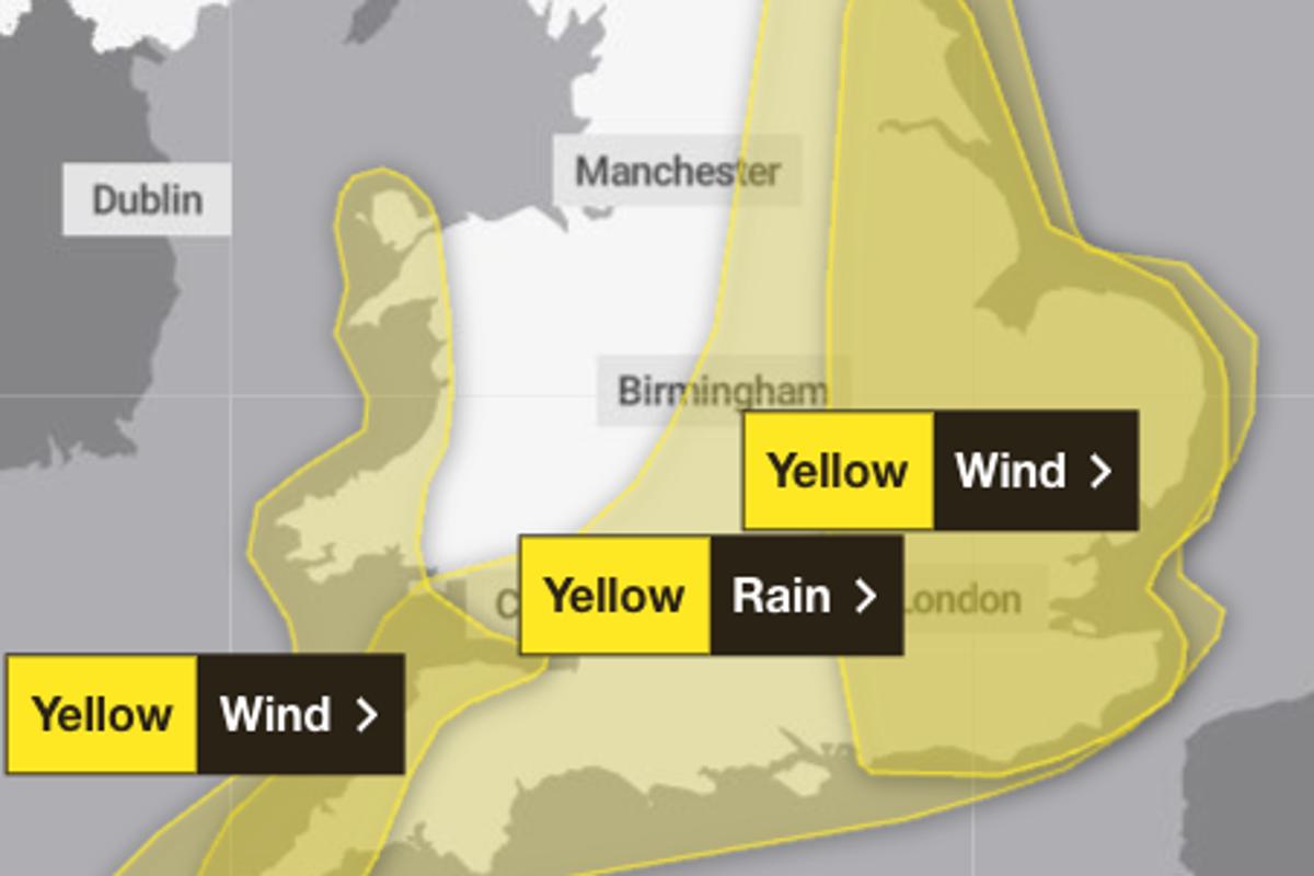
Geographic spread and timing
- Yellow rain warning – southern Scotland, northern England, Wales and parts of the Midlands from Saturday 09:00 BST until early Sunday (BBC).
- Coastal gale risk – Irish Sea shores Saturday afternoon, with gusts of 60‑70 mph possible (BBC).
The warning map published by Yahoo News shows the rain warning extending across large parts of England and Wales, while the wind warning stretches from Brighton and London up to Hull and York, and another band covers Cornwall, Devon, Somerset and west Wales.
Projected impacts
| Region | Wind gusts | Rainfall (mm) |
|---|---|---|
| Exposed coasts (south‑west Scotland, Wales) | up to 70 mph | up to 70 mm on higher ground |
| Eastern England (Thursday) | 45‑55 mph, occasional 65‑75 mph locally | up to 50 mm, with a small chance of higher amounts in north Devon and Cornwall |
| Scotland (Saturday‑Sunday) | 45‑55 mph inland, 60‑70 mph on coasts and hills | 20‑30 mm widely, 60‑80 mm on high ground |
The Met Office notes that “heavy rain may cause travel disruption and flooding in places” and that “a few homes and businesses” could be flooded. Bus and train services are likely to be affected, and coastal roads may see “large waves and beach material” thrown onto them (Independent).
Rebekah Hicks, chief meteorologist at the Met Office, warned that “the warning coincides with the first school run after the summer holidays for some, meaning a wet and potentially disruptive start to the day for many.” She added that “spray flooding on roads is expected to make journey times longer.”
Context from recent storms
The yellow warnings follow the disruptive Storm Amy earlier this month, which brought gusts of up to 100 mph and left thousands without power. The Independent highlighted that “the yellow warning for wind stretches from Brighton, London, Oxfordshire and Norwich up to Hull and York” and that “conditions are expected to turn windy with a chance of gales, initially along southern and eastern coasts.”
Lbc reported that the low‑pressure system moving in from the Atlantic is part of a series of systems that “bring the possibility of rain, high winds and thunder” and that “some have forecast gale‑force winds and extremely wet weather towards the end of the week.” The outlet also noted the upcoming storm name “Bram” from the joint naming scheme used by the Met Office, KNMI and Met Éireann.
Eoin Sherlock of Met Éireann said, “Naming storms is a powerful tool that supports us and other public safety organisations to increase awareness of severe and impactful weather alongside our weather warnings.” He cited Storm Éowyn as an example of how naming drives public attention.
What the yellow warning means for you
- Travel – Expect longer journey times, possible road closures, and disrupted rail services, especially in coastal and hill areas.
- Coastal safety – Large waves may hit southern and western shores; avoid seaside promenades and secure loose objects.
- Power cuts – Strong gusts can bring down trees and lines; be prepared with flashlights and charge devices.
- Flood risk – Watch for surface‑water flooding in low‑lying areas and be ready to follow local flood‑warning advice.
What to watch next
Model runs show the low‑pressure area deepening as it moves eastward, keeping the risk of further gusts and rain on the agenda for Sunday and Monday. The Met Office cautions that “it is not expecting to name the storm” at present, but acknowledges that “if the forecast changes in any of these regions, there is a small potential for one of these agencies to name it.”
Looking ahead to the next week, the Met Office forecasts an “unsettled weather pattern” with “outbreaks of rain, heavy at times, and strong winds” as another deep low‑pressure system crosses the UK. Temperatures are expected to hover near or just below average, with a brief warm spell on Friday that could reach 26 °C in eastern England before the cooler northerly flow arrives over the weekend.
Residents should keep an eye on updated warnings via the Met Office website, its mobile app, or social media feeds, especially if they live in the highlighted wind‑ and rain‑risk zones. The next set of alerts could arrive as early as Sunday afternoon, when gusts of 45‑55 mph inland and 60‑70 mph on coasts are predicted.
In short, the shift to a westerly regime means that the next few days will test the nation’s readiness for wind, rain and the occasional icy patch. Staying informed and prepared now will help minimise the disruption that the yellow warnings flag as likely.
How significant is this development?
Contribute your assessment to the aggregated reader sentiment ledger.
Frequently Asked Questions
Key questions answered in this reportWhat is the key development in: Met Office issues yellow wind and rain?
The Met Office has issued yellow weather warnings as a shift in the UK's weather pattern brings heavy rain, strong gusts, and potential travel disruption.
Why is this Weather development significant for the UK?
This report covers critical events in our Weather beat. Independent reporting monitors related UK statements, regulatory shifts, and public responses as further verified details emerge.
How was this reporting corroborated and verified?
Newsarchy UK compiles and cross-references reporting from primary reporting from metoffice.gov.uk and cross-checked wire reports. All coverage adheres to published editorial standards.
When was this report published?
This briefing was published on July 17, 2026 and is permanently cataloged in the Newsarchy UK Weather archives.